A CARREGAR FOTOGRAFIAS...


Parque de estacionamento (Para venda)
Referência:
GTWW-T422
/ 8053
Referência:
GTWW-T422
País:
PT
Regão:
Setúbal
Cidade:
Almada
Categoria:
Residencial
Tipo de listagem:
Para venda
Tipo de Imóvel:
Parque de estacionamento
Subtipo do Imóvel:
Garagem
Tamanho do imóvel:
485 m²
Tamanho do lote:
485 m²
Casas de Banho:
2
PRIX PAR BIEN ALMADA
PRIX DU M² DANS LES VILLES VOISINES
| Ville |
Prix m2 moyen maison |
Prix m2 moyen appartement |
|---|---|---|
| Lisboa | 6.696 EUR | 6.239 EUR |
| Algés | - | 5.511 EUR |
| Almada | 3.408 EUR | 2.916 EUR |
| Seixal | 2.887 EUR | 2.584 EUR |
| Barreiro | - | 2.116 EUR |
| Linda a Velha | - | 5.131 EUR |
| Alfragide | - | 3.379 EUR |
| Amadora | - | 2.895 EUR |
| Odivelas | 3.058 EUR | 3.387 EUR |
| Odivelas | 2.951 EUR | 3.271 EUR |
| Moita | - | 1.921 EUR |
| Belas | 3.414 EUR | 2.872 EUR |
| Moita | 1.963 EUR | 1.703 EUR |
| Quinta do Conde | 2.407 EUR | 1.947 EUR |
| Alcochete | 2.781 EUR | 3.290 EUR |
| Loures | 3.057 EUR | 3.339 EUR |
| Loures | 3.096 EUR | 3.264 EUR |
| Alcochete | 2.929 EUR | 3.747 EUR |
| Cascais | 4.560 EUR | 5.113 EUR |
Ótimo negocio!Almada é uma cidade portuguesa localizada na Área Metropolitana de Lisboa. Tem uma área urbana de 13,98 km2 e 88.202 habitantes em 2021, donde uma densidade populacional de 6.309 habitantes por km2, sendo a 10° maior cidade do país.É sede do município de Almada, que tem uma extensão de 70,21 km2 e 177.400 habitantes em 2021, com uma densidade populacional de 2.525 habitantes por km2, dividindo-se em cinco freguesias. O município é limitado a leste pelo município do Seixal, a sul pelo município de Sesimbra, a oeste pelo Oceano Atlântico e a norte pelo Estuário do Tejo.O município recebeu foral de Dom Sancho I em 1190. Juntamente com Lisboa, Sintra e Palmela, é uma das mais antigas divisões administrativas da Área Metropolitana de Lisboa. Almada foi elevada à categoria de cidade em 1973, e no seu município encontra-se também a cidade de Costa da Caparica, cujo estatuto atual lhe foi outorgado no ano de 2004.Possui como principal ponto de interesse o Santuário Nacional de Cristo Rei.Geografia
O município de Almada encontra-se no quadrante norte-ocidental da Península de Setúbal. Este tem como limites, a norte, o Gargalo do Tejo; a sudeste, o concelho do Seixal; e a sul, o concelho de Sesimbra. O seu ponto mais ocidental encontra-se na Cova do Vapor e o mais oriental na Base Naval de Lisboa, junto ao Sapal de Corroios. Cacilhas é a localidade mais setentrional do concelho, enquanto que o ponto mais meridional se encontra na zona da Adiça. O ponto mais alto do concelho, na zona do Raposo, eleva-se em 124,4 m.Quanto ao seu relevo, o concelho divide-se em duas áreas principais: a superfície de aplanação (parte da plataforma de Belverde) e a aplanação litoral.A superfície de aplanação compreende as zonas entre Trafaria, Almada, Pragal e Caparica até à linha de cumeadas entre a Sobreda e Charneca, sendo delimitada pela Arriba Fóssil da Costa de Caparica e pelas escarpas que confrontam e acompanham o Gargalo do Tejo e os municípios da margem norte do rio (as costeiras ribeirinhas, um dos seus principais elementos da paisagem). Nela, o terreno apresenta-se mais ondulado a nordeste, moderando a sua rugosidade em direção a sudoeste. A cota também decresce para sul e para o interior do concelho (onde se atingem os 60 a 80 m de cota), sendo esta tendência interrompida pela linha de cumeadas Lazarim-Capuchos (cujas alturas máximas são de 90 a 100 m). A nascente, em direção ao Mar da Palha, as suas cotas descem igualmente até atingirem máximos de 30 a 40 m. Por sua vez, estas escarpas são rasgadas por valas criadas pelas linhas de drenagem que vão desaguar no Tejo.A segunda corresponde à planície litoral da Costa de Caparica, que não excede os 11 metros de cota altimétrica. Apresenta maior largura a norte, constringindo-se gradualmente em direção a sul. A nascente, é delimitada longitudinalmente pela Arriba Fóssil da Costa de Caparica, que também dimunui de altitude em direção a meridião.O interstício entre as zonas mais altas do concelho é preenchido por uma zona depressionária marcada pelas principais linhas de água do território de Almada.Os declives mais elevados encontram-se nas duas arribas já mencionadas. Na Frente Ribeirinha Norte (nas vertentes de Arealva, Cristo Rei, Banática, Montalvão e Porto do Buxo) os declives superam os 50%. No reverso destas, as vertentes são medianamente abruptas e apresentam declives entre 5% e 16%. Entre Cacilhas, Margueira e Cova da Piedade surge uma faixa plana com declives inferiores a 5%, graças às aluviões da Vala do Caramujo e aos aterros aí construídos. A Arriba Fóssil possui declives geralmente superiores a 25%, com troços onde estes superam os 50% e com um perfil quase vertical a norte. No seu sopé, a planície costeira apresenta um declive máximo de 12%, superiores a sul da Foz do Rego devido à existência de dunas. A zona sul da plataforma litoral (Aroeira) apresenta declives insignificantes.Para o interior (já na superfície de aplanação, numa faixa entre Cacilhas, Pragal, Costas de Cão, Murfacém e Palhais) as encostas aí presentes possuem pendentes de declives muito diversos mas que variam entre médios a acentuados (entre 5% e 16%).
Categoria Energética: Isento
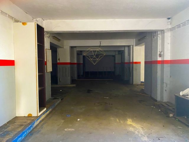
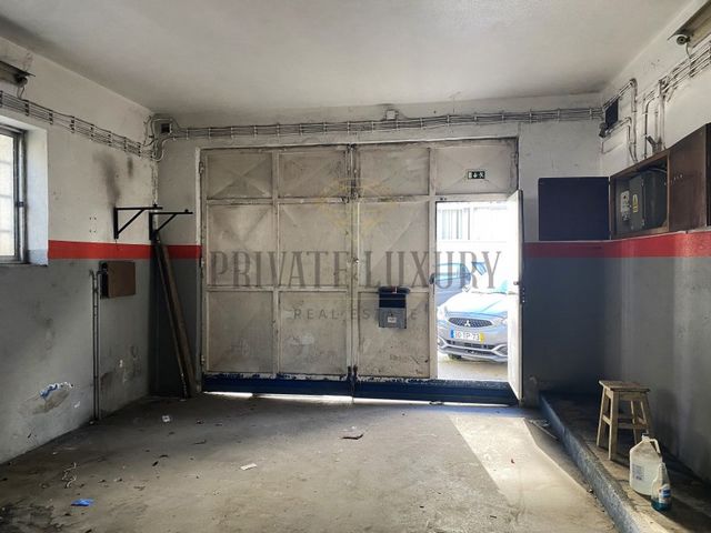
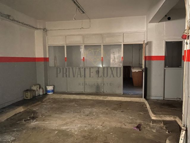
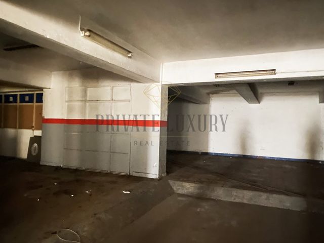
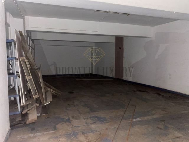
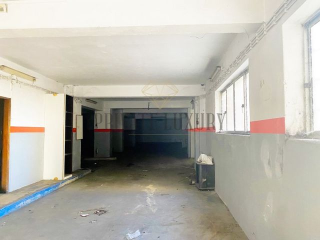
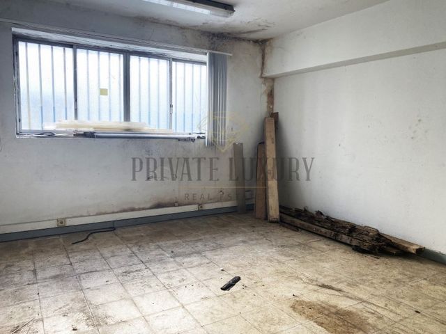
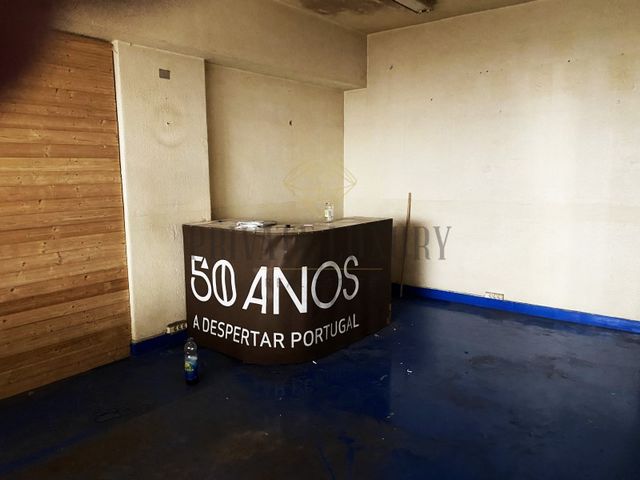
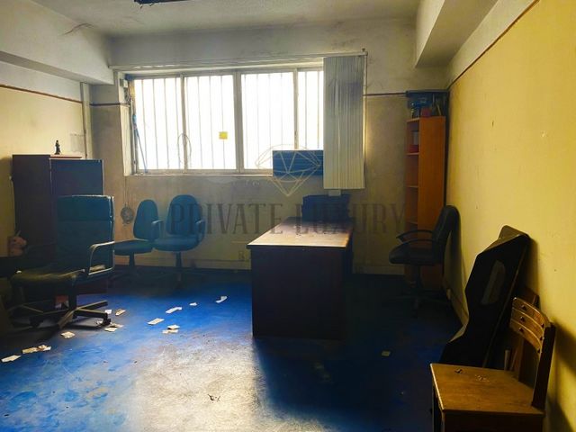
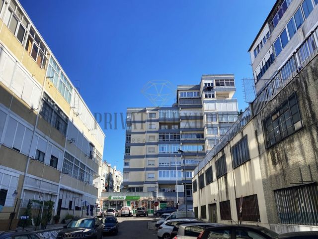
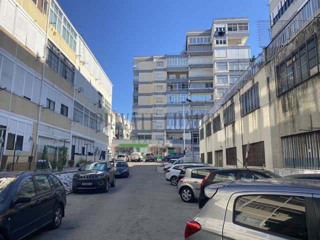
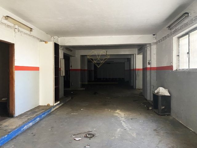
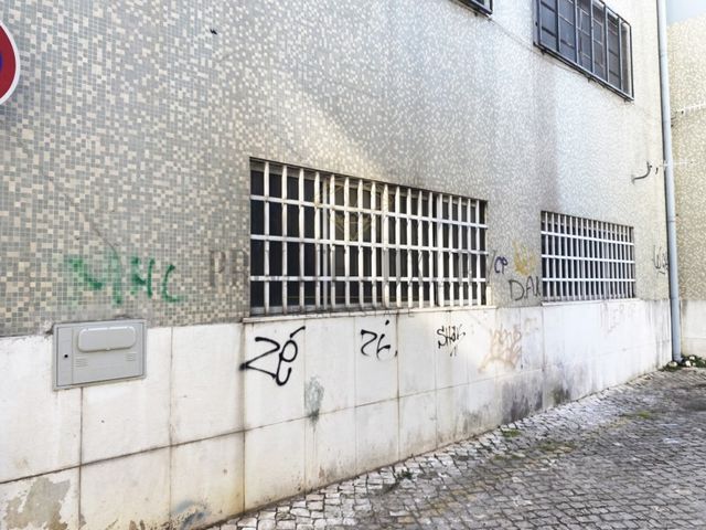
#ref:8053 Veja mais Veja menos Garagem Almada, 485m2Garagem com excelentes áreas no bairro das Barrocas em Almada.
Ótimo negocio!Almada é uma cidade portuguesa localizada na Área Metropolitana de Lisboa. Tem uma área urbana de 13,98 km2 e 88.202 habitantes em 2021, donde uma densidade populacional de 6.309 habitantes por km2, sendo a 10° maior cidade do país.É sede do município de Almada, que tem uma extensão de 70,21 km2 e 177.400 habitantes em 2021, com uma densidade populacional de 2.525 habitantes por km2, dividindo-se em cinco freguesias. O município é limitado a leste pelo município do Seixal, a sul pelo município de Sesimbra, a oeste pelo Oceano Atlântico e a norte pelo Estuário do Tejo.O município recebeu foral de Dom Sancho I em 1190. Juntamente com Lisboa, Sintra e Palmela, é uma das mais antigas divisões administrativas da Área Metropolitana de Lisboa. Almada foi elevada à categoria de cidade em 1973, e no seu município encontra-se também a cidade de Costa da Caparica, cujo estatuto atual lhe foi outorgado no ano de 2004.Possui como principal ponto de interesse o Santuário Nacional de Cristo Rei.Geografia
O município de Almada encontra-se no quadrante norte-ocidental da Península de Setúbal. Este tem como limites, a norte, o Gargalo do Tejo; a sudeste, o concelho do Seixal; e a sul, o concelho de Sesimbra. O seu ponto mais ocidental encontra-se na Cova do Vapor e o mais oriental na Base Naval de Lisboa, junto ao Sapal de Corroios. Cacilhas é a localidade mais setentrional do concelho, enquanto que o ponto mais meridional se encontra na zona da Adiça. O ponto mais alto do concelho, na zona do Raposo, eleva-se em 124,4 m.Quanto ao seu relevo, o concelho divide-se em duas áreas principais: a superfície de aplanação (parte da plataforma de Belverde) e a aplanação litoral.A superfície de aplanação compreende as zonas entre Trafaria, Almada, Pragal e Caparica até à linha de cumeadas entre a Sobreda e Charneca, sendo delimitada pela Arriba Fóssil da Costa de Caparica e pelas escarpas que confrontam e acompanham o Gargalo do Tejo e os municípios da margem norte do rio (as costeiras ribeirinhas, um dos seus principais elementos da paisagem). Nela, o terreno apresenta-se mais ondulado a nordeste, moderando a sua rugosidade em direção a sudoeste. A cota também decresce para sul e para o interior do concelho (onde se atingem os 60 a 80 m de cota), sendo esta tendência interrompida pela linha de cumeadas Lazarim-Capuchos (cujas alturas máximas são de 90 a 100 m). A nascente, em direção ao Mar da Palha, as suas cotas descem igualmente até atingirem máximos de 30 a 40 m. Por sua vez, estas escarpas são rasgadas por valas criadas pelas linhas de drenagem que vão desaguar no Tejo.A segunda corresponde à planície litoral da Costa de Caparica, que não excede os 11 metros de cota altimétrica. Apresenta maior largura a norte, constringindo-se gradualmente em direção a sul. A nascente, é delimitada longitudinalmente pela Arriba Fóssil da Costa de Caparica, que também dimunui de altitude em direção a meridião.O interstício entre as zonas mais altas do concelho é preenchido por uma zona depressionária marcada pelas principais linhas de água do território de Almada.Os declives mais elevados encontram-se nas duas arribas já mencionadas. Na Frente Ribeirinha Norte (nas vertentes de Arealva, Cristo Rei, Banática, Montalvão e Porto do Buxo) os declives superam os 50%. No reverso destas, as vertentes são medianamente abruptas e apresentam declives entre 5% e 16%. Entre Cacilhas, Margueira e Cova da Piedade surge uma faixa plana com declives inferiores a 5%, graças às aluviões da Vala do Caramujo e aos aterros aí construídos. A Arriba Fóssil possui declives geralmente superiores a 25%, com troços onde estes superam os 50% e com um perfil quase vertical a norte. No seu sopé, a planície costeira apresenta um declive máximo de 12%, superiores a sul da Foz do Rego devido à existência de dunas. A zona sul da plataforma litoral (Aroeira) apresenta declives insignificantes.Para o interior (já na superfície de aplanação, numa faixa entre Cacilhas, Pragal, Costas de Cão, Murfacém e Palhais) as encostas aí presentes possuem pendentes de declives muito diversos mas que variam entre médios a acentuados (entre 5% e 16%).
Categoria Energética: Isento
#ref:8053 Almada Garage, 485m2Garage with excellent areas in the neighborhood of Barrocas in Almada.
Great deal!Almada is a Portuguese city located in the Lisbon Metropolitan Area. It has an urban area of 13.98 km2 and 88,202 inhabitants in 2021, hence a population density of 6,309 inhabitants per km2, being the 10th largest city in the country.It is the seat of the municipality of Almada, which has an extension of 70.21 km2 and 177,400 inhabitants in 2021, with a population density of 2,525 inhabitants per km2, divided into five parishes. The municipality is bordered to the east by the municipality of Seixal, to the south by the municipality of Sesimbra, to the west by the Atlantic Ocean and to the north by the Tagus Estuary.The municipality received a charter from Dom Sancho I in 1190. Together with Lisbon, Sintra and Palmela, it is one of the oldest administrative divisions of the Lisbon Metropolitan Area. Almada was elevated to the category of city in 1973, and in its municipality is also the city of Costa da Caparica, whose current status was granted to it in 2004.It has as its main point of interest the National Sanctuary of Christ the King.Geography
The municipality of Almada is located in the north-western quadrant of the Setúbal Peninsula. This has as limits, to the north, the Tagus Bottleneck; to the southeast, the municipality of Seixal; and to the south, the municipality of Sesimbra. Its westernmost point is in Cova do Vapor and the easternmost in the Lisbon Naval Base, next to the Corroios Marshland. Cacilhas is the northernmost town of the county, while the southernmost point is in the area of Adiça. The highest point of the county, in the Raposo area, rises in 124.4 m.As for its relief, the municipality is divided into two main areas: the applanation surface (part of the Belverde platform) and the coastal planation.The applanation surface comprises the areas between Trafaria, Almada, Pragal and Caparica up to the ridge line between Sobreda and Charneca, being delimited by the Fossil Cliff of Costa de Caparica and by the escarpments that confront and accompany the Tagus Bottleneck and the municipalities of the north bank of the river (the riverside coasts, one of its main elements of the landscape). In it, the terrain is more undulating to the northeast, moderating its roughness towards the southwest. The quota also decreases to the south and to the interior of the county (where the 60 to 80 m of quota is reached), and this trend is interrupted by the line of summits Lazarim-Capuchos (whose maximum heights are from 90 to 100 m). The source, towards the Sea of Straw, its elevations also descend until they reach maximums of 30 to 40 m. In turn, these escarpments are torn by ditches created by the drainage lines that will flow into the Tagus.The second corresponds to the coastal plain of Costa de Caparica, which does not exceed 11 meters of altimetric level. It has a greater width to the north, gradually constricting towards the south. The east, is bounded longitudinally by the Fossil Cliff of Costa de Caparica, which also decreases in altitude towards meridião.The interstice between the highest areas of the municipality is filled by a depressionary zone marked by the main water lines of the territory of Almada.The highest slopes are found in the two cliffs already mentioned. In the Northern Riverfront (on the slopes of Arealva, Cristo Rei, Banática, Montalvão and Porto do Buxo) the slopes exceed 50%. On the reverse of these, the slopes are moderately abrupt and have slopes between 5% and 16%. Between Cacilhas, Margueira and Cova da Piedade there is a flat strip with slopes of less than 5%, thanks to the alluvial features of the Vala do Caramujo and the embankments built there. The Fossil Cliff has slopes generally greater than 25%, with sections where these exceed 50% and with an almost vertical profile to the north. At its foothills, the coastal plain has a maximum slope of 12%, higher than south of Foz do Rego due to the existence of dunes. The southern part of the coastal platform (Aroeira) has insignificant slopes.To the interior (already on the applanation surface, in a strip between Cacilhas, Pragal, Costas de Cão, Murfacém and Palhais) the slopes present there have slopes of very diverse slopes but ranging from medium to sharp (between 5% and 16%).
Energiekategorie: Befreit
#ref:8053 Garaje Almada, 485m2Garaje con excelentes zonas en el barrio de Barrocas en Almada.
¡Genial!Almada es una ciudad portuguesa situada en el área metropolitana de Lisboa. Tiene una superficie urbana de 13,98 km2 y 88.202 habitantes en 2021, de ahí una densidad de población de 6.309 habitantes por km2, siendo la 10ª ciudad más grande del país.Es la sede del municipio de Almada, que tiene una extensión de 70,21 km2 y 177.400 habitantes en 2021, con una densidad de población de 2.525 habitantes por km2, divididos en cinco parroquias. El municipio limita al este con el municipio de Seixal, al sur con el municipio de Sesimbra, al oeste con el Océano Atlántico y al norte con el estuario del Tajo.El municipio recibió una carta de Dom Sancho I en 1190. Junto con Lisboa, Sintra y Palmela, es una de las divisiones administrativas más antiguas del Área Metropolitana de Lisboa. Almada fue elevada a la categoría de ciudad en 1973, y en su término municipal se encuentra también la ciudad de Costa da Caparica, cuyo estatus actual le fue otorgado en 2004.Tiene como principal punto de interés el Santuario Nacional de Cristo Rey.Geografía
El municipio de Almada se encuentra en el cuadrante noroeste de la península de Setúbal. Esto tiene como límites, al norte, el cuello de botella del Tajo; al sureste, el municipio de Seixal; y al sur, el municipio de Sesimbra. Su punto más occidental está en Cova do Vapor y el más oriental en la Base Naval de Lisboa, junto a las Marismas de Corroios. Cacilhas es la ciudad más septentrional del condado, mientras que el punto más meridional se encuentra en la zona de Adiça. El punto más alto de la comarca, en la zona de Raposo, se eleva en 124,4 m.En cuanto a su relieve, el municipio se divide en dos áreas principales: la superficie de aplanamiento (parte de la plataforma Belverde) y la planificación costera.La superficie de aplanamiento comprende las áreas comprendidas entre Trafaria, Almada, Pragal y Caparica hasta la línea de cresta entre Sobreda y Charneca, estando delimitada por el Acantilado Fósil de Costa de Caparica y por los escarpes que enfrentan y acompañan al cuello de botella del Tajo y los municipios de la orilla norte del río (las costas ribereñas, uno de sus principales elementos del paisaje). En él, el terreno es más ondulado hacia el noreste, moderando su rugosidad hacia el suroeste. La cuota también disminuye hacia el sur y hacia el interior del condado (donde se alcanzan los 60 a 80 m de cuota), y esta tendencia es interrumpida por la línea de cumbres Lazarim-Capuchos (cuyas alturas máximas son de 90 a 100 m). La fuente, hacia el Mar de Paja, sus elevaciones también descienden hasta alcanzar máximos de 30 a 40 m. A su vez, estos escarpes son rasgados por zanjas creadas por las líneas de drenaje que desembocarán en el Tajo.La segunda corresponde a la llanura costera de Costa de Caparica, que no supera los 11 metros de cota altimétrica. Tiene una anchura mayor hacia el norte, constriciéndose gradualmente hacia el sur. El este, está limitado longitudinalmente por el Acantilado Fósil de Costa de Caparica, que también disminuye en altitud hacia meridião.El intersticio entre las zonas más altas del municipio está ocupado por una zona depresiva marcada por las principales líneas de agua del territorio de Almada.Las laderas más altas se encuentran en los dos acantilados ya mencionados. En la ribera norte (en las laderas de Arealva, Cristo Rei, Banática, Montalvão y Porto do Buxo) las pendientes superan el 50%. En el reverso de estos, las pendientes son moderadamente abruptas y tienen pendientes entre el 5% y el 16%. Entre Cacilhas, Margueira y Cova da Piedade hay una franja plana con pendientes inferiores al 5%, gracias a las características aluviales de la Vala do Caramujo y los terraplenes construidos allí. El Acantilado Fósil tiene pendientes generalmente superiores al 25%, con tramos donde estos superan el 50% y con un perfil casi vertical hacia el norte. En sus estribaciones, la llanura costera tiene una pendiente máxima del 12%, más alta que al sur de Foz do Rego debido a la existencia de dunas. La parte sur de la plataforma costera (Aroeira) tiene pendientes insignificantes.Al interior (ya en la superficie de aplanación, en una franja entre Cacilhas, Pragal, Costas de Cão, Murfacém y Palhais) las laderas presentes allí tienen pendientes de pendientes muy diversas pero que van de media a pronunciada (entre 5% y 16%).
Categoría Energética: Exento
#ref:8053 Garage Almada, 485m2Garage avec d'excellentes zones dans le quartier de Barrocas à Almada.
Beaucoup!Almada est une ville portugaise située dans la région métropolitaine de Lisbonne. Elle a une superficie urbaine de 13,98 km2 et 88 202 habitants en 2021, soit une densité de population de 6 309 habitants par km2, ce qui en fait la 10ème plus grande ville du pays.C'est le siège de la municipalité d'Almada, qui a une extension de 70,21 km2 et 177 400 habitants en 2021, avec une densité de population de 2 525 habitants par km2, divisée en cinq paroisses. La commune est bordée à l'est par la commune de Seixal, au sud par la commune de Sesimbra, à l'ouest par l'océan Atlantique et au nord par l'estuaire du Tage.La municipalité a reçu une charte de Dom Sancho I en 1190. Avec Lisbonne, Sintra et Palmela, c'est l'une des plus anciennes divisions administratives de la région métropolitaine de Lisbonne. Almada a été élevée à la catégorie de ville en 1973, et dans sa municipalité est également la ville de Costa da Caparica, dont le statut actuel lui a été accordé en 2004.Il a comme principal point d'intérêt le sanctuaire national du Christ Roi.Géographie
La municipalité d'Almada est située dans le quadrant nord-ouest de la péninsule de Setúbal. Cela a comme limites, au nord, le goulot d'étranglement du Tage; au sud-est, la commune de Seixal; et au sud, la municipalité de Sesimbra. Son point le plus occidental est à Cova do Vapor et le plus à l'est dans la base navale de Lisbonne, à côté du marais de Corroios. Cacilhas est la ville la plus septentrionale du comté, tandis que le point le plus méridional se trouve dans la région d'Adiça. Le point culminant du comté, dans la région de Raposo, culmine à 124,4 m.En ce qui concerne son relief, la municipalité est divisée en deux zones principales: la surface d'applanation (partie de la plate-forme Belverde) et la planation côtière.La surface d'applanation comprend les zones entre Trafaria, Almada, Pragal et Caparica jusqu'à la ligne de crête entre Sobreda et Charneca, délimitées par la falaise fossile de Costa de Caparica et par les escarpements qui affrontent et accompagnent le goulot d'étranglement du Tage et les municipalités de la rive nord du fleuve (les côtes riveraines, l'un de ses principaux éléments du paysage). Dans celui-ci, le terrain est plus vallonné vers le nord-est, modérant sa rugosité vers le sud-ouest. Le quota diminue également vers le sud et à l'intérieur du comté (où les 60 à 80 m de quota sont atteints), et cette tendance est interrompue par la ligne de sommets Lazarim-Capuchos (dont les hauteurs maximales sont de 90 à 100 m). La source, vers la mer de paille, ses élévations descendent également jusqu'à atteindre des maximums de 30 à 40 m. À leur tour, ces escarpements sont déchirés par des fossés créés par les lignes de drainage qui se jetteront dans le Tage.La seconde correspond à la plaine côtière de la Costa de Caparica, qui ne dépasse pas 11 mètres de niveau altimétrique. Il a une plus grande largeur vers le nord, se resserrant progressivement vers le sud. L'est, est délimité longitudinalement par la falaise fossile de Costa de Caparica, qui diminue également en altitude vers meridião.L'interstice entre les zones les plus élevées de la municipalité est rempli par une zone de dépression marquée par les principales conduites d'eau du territoire d'Almada.Les pentes les plus élevées se trouvent dans les deux falaises déjà mentionnées. Dans le front de mer nord (sur les pentes d'Arealva, Cristo Rei, Banática, Montalvão et Porto do Buxo), les pentes dépassent 50%. Au verso de ceux-ci, les pentes sont modérément abruptes et ont des pentes comprises entre 5% et 16%. Entre Cacilhas, Margueira et Cova da Piedade, il y a une bande plate avec des pentes de moins de 5%, grâce aux caractéristiques alluviales du Vala do Caramujo et aux remblais qui y sont construits. La falaise fossile a des pentes généralement supérieures à 25%, avec des sections où celles-ci dépassent 50% et avec un profil presque vertical au nord. Au pied de ses contreforts, la plaine côtière a une pente maximale de 12%, plus élevée qu'au sud de Foz do Rego en raison de l'existence de dunes. La partie sud de la plate-forme côtière (Aroeira) a des pentes insignifiantes.À l'intérieur (déjà sur la surface d'applanation, dans une bande entre Cacilhas, Pragal, Costas de Cão, Murfacém et Palhais), les pentes présentes ont des pentes de pentes très diverses mais allant de moyennes à fortes (entre 5% et 16%).
Performance Énergétique: Exempt
#ref:8053 Almada Garage, 485m2Garage with excellent areas in the neighborhood of Barrocas in Almada.
Great deal!Almada is a Portuguese city located in the Lisbon Metropolitan Area. It has an urban area of 13.98 km2 and 88,202 inhabitants in 2021, hence a population density of 6,309 inhabitants per km2, being the 10th largest city in the country.It is the seat of the municipality of Almada, which has an extension of 70.21 km2 and 177,400 inhabitants in 2021, with a population density of 2,525 inhabitants per km2, divided into five parishes. The municipality is bordered to the east by the municipality of Seixal, to the south by the municipality of Sesimbra, to the west by the Atlantic Ocean and to the north by the Tagus Estuary.The municipality received a charter from Dom Sancho I in 1190. Together with Lisbon, Sintra and Palmela, it is one of the oldest administrative divisions of the Lisbon Metropolitan Area. Almada was elevated to the category of city in 1973, and in its municipality is also the city of Costa da Caparica, whose current status was granted to it in 2004.It has as its main point of interest the National Sanctuary of Christ the King.Geography
The municipality of Almada is located in the north-western quadrant of the Setúbal Peninsula. This has as limits, to the north, the Tagus Bottleneck; to the southeast, the municipality of Seixal; and to the south, the municipality of Sesimbra. Its westernmost point is in Cova do Vapor and the easternmost in the Lisbon Naval Base, next to the Corroios Marshland. Cacilhas is the northernmost town of the county, while the southernmost point is in the area of Adiça. The highest point of the county, in the Raposo area, rises in 124.4 m.As for its relief, the municipality is divided into two main areas: the applanation surface (part of the Belverde platform) and the coastal planation.The applanation surface comprises the areas between Trafaria, Almada, Pragal and Caparica up to the ridge line between Sobreda and Charneca, being delimited by the Fossil Cliff of Costa de Caparica and by the escarpments that confront and accompany the Tagus Bottleneck and the municipalities of the north bank of the river (the riverside coasts, one of its main elements of the landscape). In it, the terrain is more undulating to the northeast, moderating its roughness towards the southwest. The quota also decreases to the south and to the interior of the county (where the 60 to 80 m of quota is reached), and this trend is interrupted by the line of summits Lazarim-Capuchos (whose maximum heights are from 90 to 100 m). The source, towards the Sea of Straw, its elevations also descend until they reach maximums of 30 to 40 m. In turn, these escarpments are torn by ditches created by the drainage lines that will flow into the Tagus.The second corresponds to the coastal plain of Costa de Caparica, which does not exceed 11 meters of altimetric level. It has a greater width to the north, gradually constricting towards the south. The east, is bounded longitudinally by the Fossil Cliff of Costa de Caparica, which also decreases in altitude towards meridião.The interstice between the highest areas of the municipality is filled by a depressionary zone marked by the main water lines of the territory of Almada.The highest slopes are found in the two cliffs already mentioned. In the Northern Riverfront (on the slopes of Arealva, Cristo Rei, Banática, Montalvão and Porto do Buxo) the slopes exceed 50%. On the reverse of these, the slopes are moderately abrupt and have slopes between 5% and 16%. Between Cacilhas, Margueira and Cova da Piedade there is a flat strip with slopes of less than 5%, thanks to the alluvial features of the Vala do Caramujo and the embankments built there. The Fossil Cliff has slopes generally greater than 25%, with sections where these exceed 50% and with an almost vertical profile to the north. At its foothills, the coastal plain has a maximum slope of 12%, higher than south of Foz do Rego due to the existence of dunes. The southern part of the coastal platform (Aroeira) has insignificant slopes.To the interior (already on the applanation surface, in a strip between Cacilhas, Pragal, Costas de Cão, Murfacém and Palhais) the slopes present there have slopes of very diverse slopes but ranging from medium to sharp (between 5% and 16%).
Energy Rating: Exempt
#ref:8053 Almada Garage, 485m2Garage with excellent areas in the neighborhood of Barrocas in Almada.
Great deal!Almada is a Portuguese city located in the Lisbon Metropolitan Area. It has an urban area of 13.98 km2 and 88,202 inhabitants in 2021, hence a population density of 6,309 inhabitants per km2, being the 10th largest city in the country.It is the seat of the municipality of Almada, which has an extension of 70.21 km2 and 177,400 inhabitants in 2021, with a population density of 2,525 inhabitants per km2, divided into five parishes. The municipality is bordered to the east by the municipality of Seixal, to the south by the municipality of Sesimbra, to the west by the Atlantic Ocean and to the north by the Tagus Estuary.The municipality received a charter from Dom Sancho I in 1190. Together with Lisbon, Sintra and Palmela, it is one of the oldest administrative divisions of the Lisbon Metropolitan Area. Almada was elevated to the category of city in 1973, and in its municipality is also the city of Costa da Caparica, whose current status was granted to it in 2004.It has as its main point of interest the National Sanctuary of Christ the King.Geography
The municipality of Almada is located in the north-western quadrant of the Setúbal Peninsula. This has as limits, to the north, the Tagus Bottleneck; to the southeast, the municipality of Seixal; and to the south, the municipality of Sesimbra. Its westernmost point is in Cova do Vapor and the easternmost in the Lisbon Naval Base, next to the Corroios Marshland. Cacilhas is the northernmost town of the county, while the southernmost point is in the area of Adiça. The highest point of the county, in the Raposo area, rises in 124.4 m.As for its relief, the municipality is divided into two main areas: the applanation surface (part of the Belverde platform) and the coastal planation.The applanation surface comprises the areas between Trafaria, Almada, Pragal and Caparica up to the ridge line between Sobreda and Charneca, being delimited by the Fossil Cliff of Costa de Caparica and by the escarpments that confront and accompany the Tagus Bottleneck and the municipalities of the north bank of the river (the riverside coasts, one of its main elements of the landscape). In it, the terrain is more undulating to the northeast, moderating its roughness towards the southwest. The quota also decreases to the south and to the interior of the county (where the 60 to 80 m of quota is reached), and this trend is interrupted by the line of summits Lazarim-Capuchos (whose maximum heights are from 90 to 100 m). The source, towards the Sea of Straw, its elevations also descend until they reach maximums of 30 to 40 m. In turn, these escarpments are torn by ditches created by the drainage lines that will flow into the Tagus.The second corresponds to the coastal plain of Costa de Caparica, which does not exceed 11 meters of altimetric level. It has a greater width to the north, gradually constricting towards the south. The east, is bounded longitudinally by the Fossil Cliff of Costa de Caparica, which also decreases in altitude towards meridião.The interstice between the highest areas of the municipality is filled by a depressionary zone marked by the main water lines of the territory of Almada.The highest slopes are found in the two cliffs already mentioned. In the Northern Riverfront (on the slopes of Arealva, Cristo Rei, Banática, Montalvão and Porto do Buxo) the slopes exceed 50%. On the reverse of these, the slopes are moderately abrupt and have slopes between 5% and 16%. Between Cacilhas, Margueira and Cova da Piedade there is a flat strip with slopes of less than 5%, thanks to the alluvial features of the Vala do Caramujo and the embankments built there. The Fossil Cliff has slopes generally greater than 25%, with sections where these exceed 50% and with an almost vertical profile to the north. At its foothills, the coastal plain has a maximum slope of 12%, higher than south of Foz do Rego due to the existence of dunes. The southern part of the coastal platform (Aroeira) has insignificant slopes.To the interior (already on the applanation surface, in a strip between Cacilhas, Pragal, Costas de Cão, Murfacém and Palhais) the slopes present there have slopes of very diverse slopes but ranging from medium to sharp (between 5% and 16%).
Energie Categorie: Gratis
#ref:8053 Almada Garage, 485m2Garage with excellent areas in the neighborhood of Barrocas in Almada.
Great deal!Almada is a Portuguese city located in the Lisbon Metropolitan Area. It has an urban area of 13.98 km2 and 88,202 inhabitants in 2021, hence a population density of 6,309 inhabitants per km2, being the 10th largest city in the country.It is the seat of the municipality of Almada, which has an extension of 70.21 km2 and 177,400 inhabitants in 2021, with a population density of 2,525 inhabitants per km2, divided into five parishes. The municipality is bordered to the east by the municipality of Seixal, to the south by the municipality of Sesimbra, to the west by the Atlantic Ocean and to the north by the Tagus Estuary.The municipality received a charter from Dom Sancho I in 1190. Together with Lisbon, Sintra and Palmela, it is one of the oldest administrative divisions of the Lisbon Metropolitan Area. Almada was elevated to the category of city in 1973, and in its municipality is also the city of Costa da Caparica, whose current status was granted to it in 2004.It has as its main point of interest the National Sanctuary of Christ the King.Geography
The municipality of Almada is located in the north-western quadrant of the Setúbal Peninsula. This has as limits, to the north, the Tagus Bottleneck; to the southeast, the municipality of Seixal; and to the south, the municipality of Sesimbra. Its westernmost point is in Cova do Vapor and the easternmost in the Lisbon Naval Base, next to the Corroios Marshland. Cacilhas is the northernmost town of the county, while the southernmost point is in the area of Adiça. The highest point of the county, in the Raposo area, rises in 124.4 m.As for its relief, the municipality is divided into two main areas: the applanation surface (part of the Belverde platform) and the coastal planation.The applanation surface comprises the areas between Trafaria, Almada, Pragal and Caparica up to the ridge line between Sobreda and Charneca, being delimited by the Fossil Cliff of Costa de Caparica and by the escarpments that confront and accompany the Tagus Bottleneck and the municipalities of the north bank of the river (the riverside coasts, one of its main elements of the landscape). In it, the terrain is more undulating to the northeast, moderating its roughness towards the southwest. The quota also decreases to the south and to the interior of the county (where the 60 to 80 m of quota is reached), and this trend is interrupted by the line of summits Lazarim-Capuchos (whose maximum heights are from 90 to 100 m). The source, towards the Sea of Straw, its elevations also descend until they reach maximums of 30 to 40 m. In turn, these escarpments are torn by ditches created by the drainage lines that will flow into the Tagus.The second corresponds to the coastal plain of Costa de Caparica, which does not exceed 11 meters of altimetric level. It has a greater width to the north, gradually constricting towards the south. The east, is bounded longitudinally by the Fossil Cliff of Costa de Caparica, which also decreases in altitude towards meridião.The interstice between the highest areas of the municipality is filled by a depressionary zone marked by the main water lines of the territory of Almada.The highest slopes are found in the two cliffs already mentioned. In the Northern Riverfront (on the slopes of Arealva, Cristo Rei, Banática, Montalvão and Porto do Buxo) the slopes exceed 50%. On the reverse of these, the slopes are moderately abrupt and have slopes between 5% and 16%. Between Cacilhas, Margueira and Cova da Piedade there is a flat strip with slopes of less than 5%, thanks to the alluvial features of the Vala do Caramujo and the embankments built there. The Fossil Cliff has slopes generally greater than 25%, with sections where these exceed 50% and with an almost vertical profile to the north. At its foothills, the coastal plain has a maximum slope of 12%, higher than south of Foz do Rego due to the existence of dunes. The southern part of the coastal platform (Aroeira) has insignificant slopes.To the interior (already on the applanation surface, in a strip between Cacilhas, Pragal, Costas de Cão, Murfacém and Palhais) the slopes present there have slopes of very diverse slopes but ranging from medium to sharp (between 5% and 16%).
:
#ref:8053 Almada Garage, 485m2Garage with excellent areas in the neighborhood of Barrocas in Almada.
Great deal!Almada is a Portuguese city located in the Lisbon Metropolitan Area. It has an urban area of 13.98 km2 and 88,202 inhabitants in 2021, hence a population density of 6,309 inhabitants per km2, being the 10th largest city in the country.It is the seat of the municipality of Almada, which has an extension of 70.21 km2 and 177,400 inhabitants in 2021, with a population density of 2,525 inhabitants per km2, divided into five parishes. The municipality is bordered to the east by the municipality of Seixal, to the south by the municipality of Sesimbra, to the west by the Atlantic Ocean and to the north by the Tagus Estuary.The municipality received a charter from Dom Sancho I in 1190. Together with Lisbon, Sintra and Palmela, it is one of the oldest administrative divisions of the Lisbon Metropolitan Area. Almada was elevated to the category of city in 1973, and in its municipality is also the city of Costa da Caparica, whose current status was granted to it in 2004.It has as its main point of interest the National Sanctuary of Christ the King.Geography
The municipality of Almada is located in the north-western quadrant of the Setúbal Peninsula. This has as limits, to the north, the Tagus Bottleneck; to the southeast, the municipality of Seixal; and to the south, the municipality of Sesimbra. Its westernmost point is in Cova do Vapor and the easternmost in the Lisbon Naval Base, next to the Corroios Marshland. Cacilhas is the northernmost town of the county, while the southernmost point is in the area of Adiça. The highest point of the county, in the Raposo area, rises in 124.4 m.As for its relief, the municipality is divided into two main areas: the applanation surface (part of the Belverde platform) and the coastal planation.The applanation surface comprises the areas between Trafaria, Almada, Pragal and Caparica up to the ridge line between Sobreda and Charneca, being delimited by the Fossil Cliff of Costa de Caparica and by the escarpments that confront and accompany the Tagus Bottleneck and the municipalities of the north bank of the river (the riverside coasts, one of its main elements of the landscape). In it, the terrain is more undulating to the northeast, moderating its roughness towards the southwest. The quota also decreases to the south and to the interior of the county (where the 60 to 80 m of quota is reached), and this trend is interrupted by the line of summits Lazarim-Capuchos (whose maximum heights are from 90 to 100 m). The source, towards the Sea of Straw, its elevations also descend until they reach maximums of 30 to 40 m. In turn, these escarpments are torn by ditches created by the drainage lines that will flow into the Tagus.The second corresponds to the coastal plain of Costa de Caparica, which does not exceed 11 meters of altimetric level. It has a greater width to the north, gradually constricting towards the south. The east, is bounded longitudinally by the Fossil Cliff of Costa de Caparica, which also decreases in altitude towards meridião.The interstice between the highest areas of the municipality is filled by a depressionary zone marked by the main water lines of the territory of Almada.The highest slopes are found in the two cliffs already mentioned. In the Northern Riverfront (on the slopes of Arealva, Cristo Rei, Banática, Montalvão and Porto do Buxo) the slopes exceed 50%. On the reverse of these, the slopes are moderately abrupt and have slopes between 5% and 16%. Between Cacilhas, Margueira and Cova da Piedade there is a flat strip with slopes of less than 5%, thanks to the alluvial features of the Vala do Caramujo and the embankments built there. The Fossil Cliff has slopes generally greater than 25%, with sections where these exceed 50% and with an almost vertical profile to the north. At its foothills, the coastal plain has a maximum slope of 12%, higher than south of Foz do Rego due to the existence of dunes. The southern part of the coastal platform (Aroeira) has insignificant slopes.To the interior (already on the applanation surface, in a strip between Cacilhas, Pragal, Costas de Cão, Murfacém and Palhais) the slopes present there have slopes of very diverse slopes but ranging from medium to sharp (between 5% and 16%).
Energy Rating: Exempt
#ref:8053